Start with one known dimension.
Carry scale across the same image.
Calibrate a blueprint, floor plan, sketch, or plan-like photo from a reliable visible length. Estimate real-world length and rectangular area, or click around an irregular shape to calculate its scaled perimeter and area.
Runs in your browser · No upload · No measured values sent to Takeoff
Known-dimension calibration
Blueprint scale calculator
Measure the reference and target with one consistent screen, paper, or image unit. The arithmetic uses their ratio; pixels alone do not establish real scale. On an image, calibrate first and then trace an irregular area point by point.
Optional local point picker
Measure directly on an image.
Load a PNG, JPEG, or WebP from this device, then capture each distance with two clicks. The file stays in this browser tab and is never submitted with the launch form.
Load an image, choose a measurement, then click its two endpoints.
- Trace points
- 0
- Closed perimeter
- 0.00 ft
- Traced area
- 0.00 sq ft
- Traced area
- 0.00 sq yd
Keyboard or screen-reader users can enter the same calibration and rectangular measurements in the fields below. Polygon tracing currently requires pointer input.
No image loaded. Your local file will appear here without being uploaded.
Calculated result
- Calibration
- 0.069252 ft/px
- Target length
- 100.00 ft
- Target width
- 60.00 ft
- Perimeter
- 320.00 ft
- Rectangular area
- 666.67 sq yd
- Rectangular area
- 6,000.00 sq ft
100.00 ft divided by 1,444.00 pixels.
Planning aid only. Every target measurement must come from the same image, print scale, zoom level, and physical plane as the known reference. Perspective, lens distortion, terrain, hidden edges, scan stretch, print scaling, source age, and self-intersecting traces can invalidate the result. This is not a boundary survey, engineered measurement, or substitute for field verification.
Checking a multi-page PDF? Watch the sheet-scale check tutorial to see why a valid reference on one sheet may be wrong on the next—and why a second dimension matters.
Worked scale example
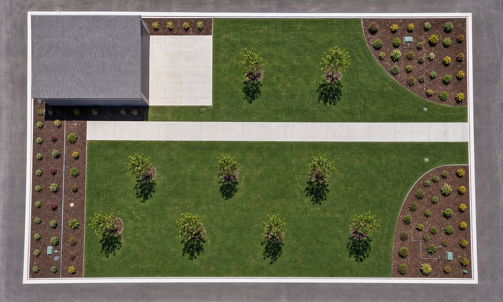
Use a 100-foot edge to measure the courtyard.
The practice image defines its north edge as 100 feet across 1,444 pixels. That scale converts a 1,444-by-866.4-pixel rectangle into the designed 100-by-60-foot, 6,000-square-foot courtyard.
- Known edge
- 100 ft
- Measured edge
- 1,444 px
- Scale
- 0.069252 ft/px
- Designed dimensions
- 100 × 60 ft
- Designed area
- 6,000 SF
- Freehand trace
- 6,094.18 SF
A freehand polygon trace measured 6,094.18 SF, 1.57% above the designed rectangle on this image. That is not a promised accuracy rate; no calculator can correct distorted imagery or an unreliable reference dimension.